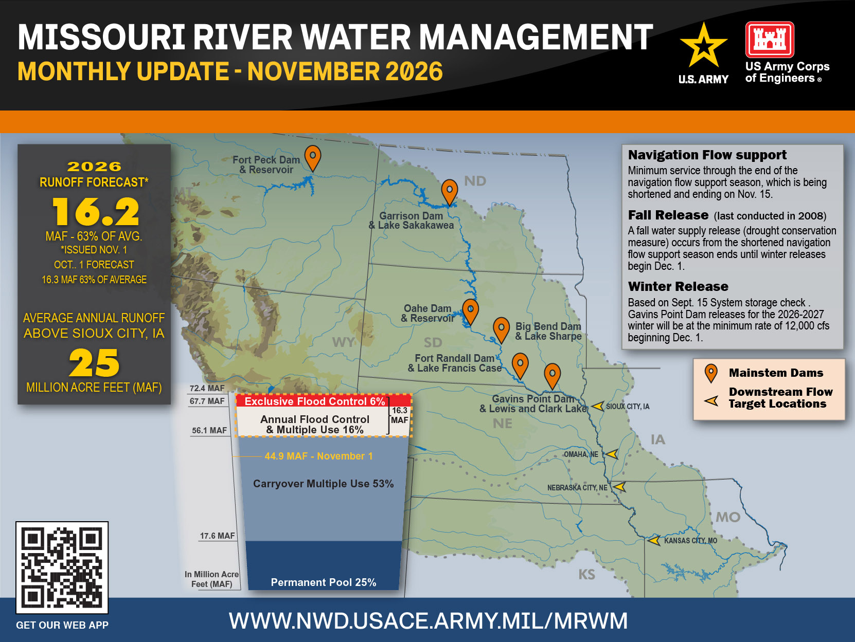
OMAHA, Neb. — Gavins Point Dam releases will be reduced in early November as flow support to navigation ends. Releases are currently 24,500 cubic feet per second. “We will continue to make releases from Gavins Point Dam to provide flow support at minimum service through the end of the navigation flow support season. Due to the persisting drought in the upper Basin, the season is being shortened and will be ending on Nov. 15 at the mouth of the Missouri River,” said John Remus, chief of the USACE, Missouri River Water Management Division. The normal season ending date is Dec. 1.
Release reductions to the fall rate began Nov. 6. Releases will be reduced by 3,000 cfs each day until reaching a rate of 9,000 cfs. A fall water supply release, which last occurred in 2008, is another drought conservation measure that occurs from the end of a shortened navigation flow support season until the winter release begins on Dec. 1. Fort Randall releases will be stepped down in a similar manner, approximately one day prior to the Gavins Point reductions.
October runoff in the Missouri River basin above Sioux City, Iowa, was 0.7 million-acre-feet (MAF), which is 61% of average. Runoff was below normal in all the reaches except Sioux City, which was near normal. Based on the most recent Drought Monitor, about 60% of the Basin is currently in abnormally dry or drought conditions. Drought conditions through January 2027 are expected to persist or expand in Montana, Wyoming, and the western Dakotas but could improve in central South Dakota, the eastern Dakotas, and western Nebraska. The 2026 calendar year runoff forecast for the upper Basin, updated on Nov. 1, is 16.2 MAF, 63% of average.
Reservoir studies indicate System storage will be below the base of the flood control storage zone at the start of the 2027 runoff season. System storage is forecast to be about 44.8 MAF, which is 11.3 MAF into the System’s Carryover and Multiple Use Zone. This means that the Fort Peck, Garrison, and Oahe reservoirs are expected to be approximately 14 to 16 feet below the base of their respective flood control zones on March 1, 2027.


Comments