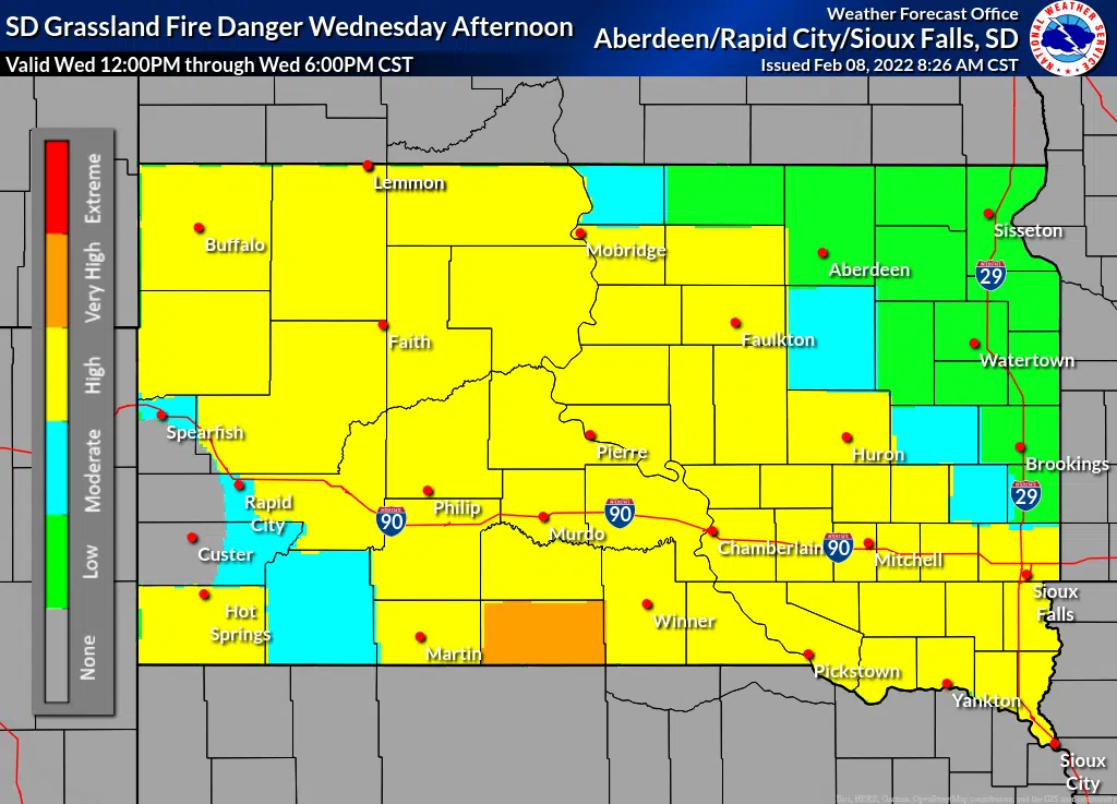
The National Weather Service has put much of southern South Dakota in the Extreme Fire Danger for this afternoon (Feb. 8, 2022) and a Wind Advisory is in effect from 11am-6pm CT today.
The area included in the Extreme Fire Danger stretches from Rapid City to Pierre to Mitchell to Yankton. The NWS says because of windy conditions and very low moisture content of grasses and other organic material on the ground, all fires have the potential to become large and spread quickly throughout the Missouri River valley.
The forecast for tomorrow (Feb. 9, 2022) puts the grassland fire danger
index in the “High” category. Gusty northwest winds will continue, but will not be as strong as the speeds experienced today. Afternoon humidity will generally range from 40 to 50 percent over central South Dakota, where fire danger will be elevated once again. By late Wednesday afternoon, there could be some areas of light rain or rain mixed with snow working southward across Corson County down to Jones County.
When Hughes or Stanley counties are in the “Very High” or “Extreme” fire danger categories, an open burn ban is automatically in effect. The Hughes County website has a link to the Grassland Fire Danger map in the lower, right hand corner.


National Weather Service Grassland Fire Danger Index for Feb. 8, 2022.
Image credit NWS.

National Weather Service Grassland PROJECTED Fire Danger Index for Feb. 9, 2022.
Image credit NWS.


Comments