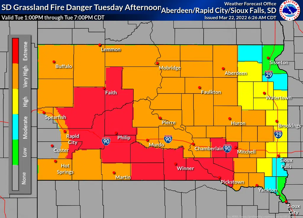
The National Weather Service has put much of central South Dakota in the Very High Fire Danger category for this afternoon (March 22, 2022) while some counties to the south and west are in the Extreme Fire Danger category.
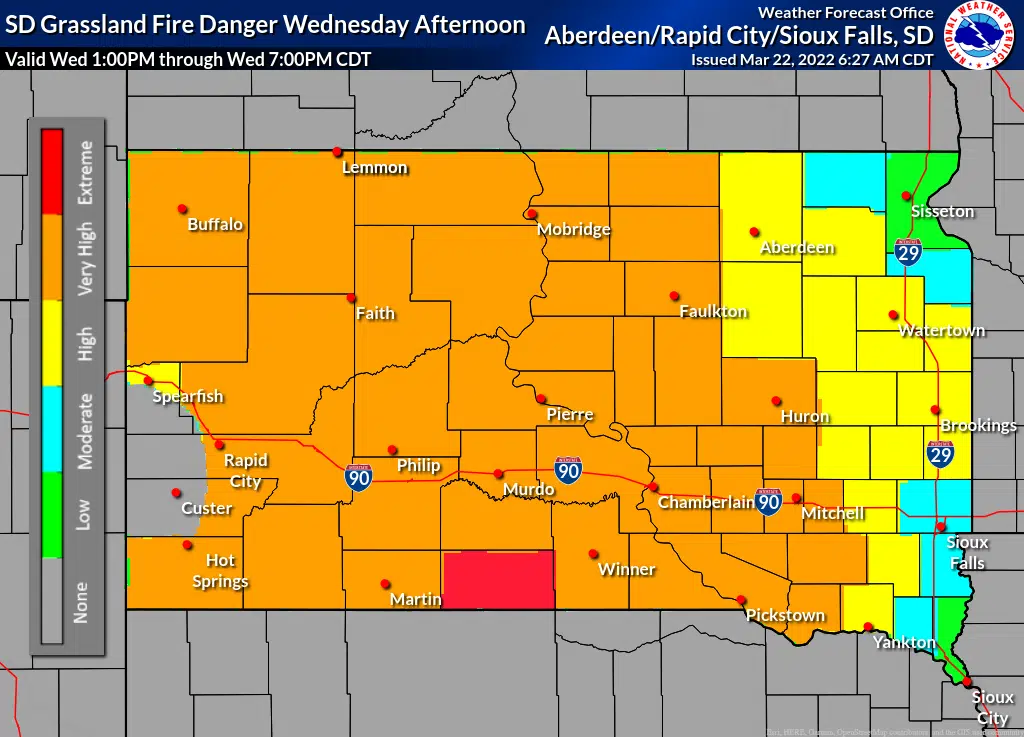
NWS says north winds gusting as high as 45 mph are expected across the middle of the state this afternoon, while afternoon humidity will get low once again. Gusty north winds are also forecast tomorrow, with similar low humidity values expected.
When Hughes or Stanley counties are in the “Very High” or “Extreme” fire danger categories, an open burn ban is automatically in effect. The Hughes County website has a link to the Grassland Fire Danger map in the lower, right hand corner.
Counties included in today’s Very High Fire Danger category include: Corson, Campbell, McPherson, Brown, Walworth, Edmunds, Dewey, Potter, Faulk, Spink, Stanley, Sully, Hughes, Hyde, Hand, Jones, Lyman and Buffalo. Among the counties in the Extreme Fire Danger category are Haakon, Ziebach, Jackson, Mellette, Todd, Tripp, Gregory, Aurora and Davison.
Including the cities of McIntosh, Herreid, Eureka, Aberdeen, Mobridge, Ipswich, Isabel, Gettysburg, Faulkton, Redfield, Fort Pierre, Onida, Pierre, Highmore, Miller, Murdo, Kennebec and Fort Thompson.

National Weather Service Grassland Fire Danger Index for March 22, 2022.
Image credit NWS.

ANTICIPATED National Weather Service Grassland Fire Danger Index for March 23, 2022.
Image credit NWS.


Comments