JULY 18, 2024:
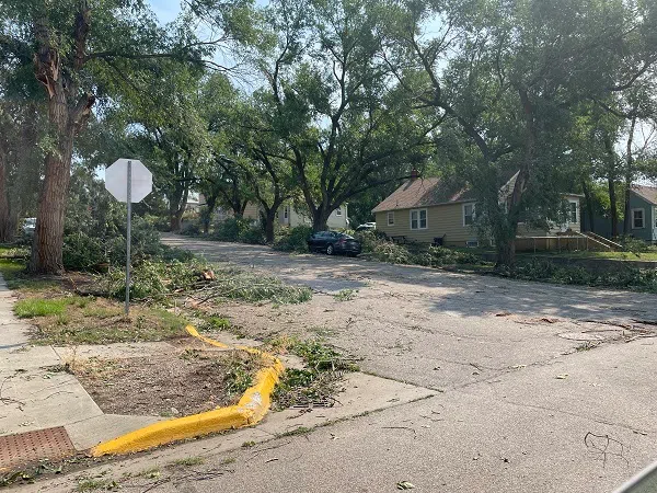
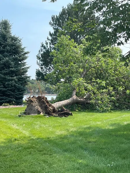
A storm with some wind gusts exceeding 80mph blew through central South Dakota early Sunday morning (July 14, 2024) damaging trees and causing thousands of dollars in damage to structures and vehicles.
National Weather Service Meteorologist Ryan Vipond says a South Dakota State University Mesonet site in Stanley County clocked a wind gust at 109mph. He told DRG Media Group earlier this week that preliminary information showed no rotation in the storm, only strong wind.
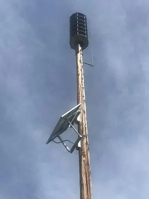
The intensity of the storm had many Hughes and Stanley County residents wondering why the storm warning sirens didn’t go off. Earlier this year, county Emergency Manager Troy Blevins told DRG Media Group that people should not think of storm sirens as being their first warning that severe weather is coming.
Audio PlayerBlevins says outdoor storm sirens are meant to alert individuals who are outside that threatening weather or danger is approaching, directing them to move inside, seek shelter and get accurate information. He says for people indoors, it’s important to have a NOAA weather radio or a weather app to let you know severe weather is nearby.
Blevins encourages Hughes and Stanley county residents to make sure that the wireless emergency alert setting on your cell phone is turned “ON.” He says the National Weather Service “Emergency Alert” message should come in front of the storm, giving you time to react and seek shelter.
If you have any questions or concerns, contact Blevins at 605-773-7454.
WRITTEN VERSION: From Hughes/Stanley County Emergency Manager Troy Blevins:
“Due to the severe weather that affected our communities this past Sunday morning, I would like to help clarify how Hughes County and Stanley County outdoor sirens are designed to be used. There exists a dangerous myth that outdoor sirens are designed to alert you in your home, workplace, vehicle, camper, RV, or any indoor facility that you may be in. That information is false. Emergency Management and public safety officials cannot begin to stress how dangerous and life threatening that thought process is.
“Manufacturers of outdoor sirens design them for a single purpose, to be heard outdoors in several different directions. Sirens are meant to alert individuals who are outside that threatening weather or danger is approaching, directing them to move inside, seek shelter and get accurate information. Communities that have a policy of sounding their outdoor sirens for storms have a valid reason to do so, as they are alerting individuals who are outdoors that danger is imminent.
“Outdoor sirens are not the primary alert method for people indoors. When severe weather strikes at night or in the early morning hours, it is important to have a NOAA weather radio in your home or a weather app on your phone to alert you and your family. Depending on the severity of the storm, the National Weather Service may send out an “Emergency Alert” message through your cell phones. This message will have the same tone as an “Amber Alert” tone and will inform you of approaching severe weather. The National Weather Service “Emergency Alert” message should lead the storm, giving you time to react and seek shelter. Take the time to ensure the wireless emergency alert feature is “ON” on your cell phone. Your local radio or television stations can also assist with up-to-date severe weather information.
“Preparing for severe weather should start immediately. If a severe thunderstorm watch is issued for Hughes County or Stanley County, that is the time to activate your plan. Severe weather is very unpredictable; storms can change their paths and fluctuate in severity. Always be prepared and know what to do before a severe thunderstorm warning is issued. Being prepared is everyone’s responsibility. Check the weather before you travel or engage in any outdoor activity.
“For more preparedness information go to www.ready.gov.
“If you have any questions or concerns, please contact Troy Blevins, Hughes/Stanley County Emergency Management at 605-773-7454.”
JULY 15, 2024:
A storm with some wind gusts exceeding 80mph blew through central South Dakota early Sunday morning (July 14, 2024).
Ryan Vipond is a meteorologist with the National Weather Service Office in Aberdeen. He says some places saw wind gusts at 90mph or more.
Audio PlayerVipond says the storm started in the Corson and Dewey County areas, then traveled south and east.
Audio PlayerIn Stanley County, Vipond says a South Dakota State University Mesonet site clocked the wind at more than 100mph.
Audio PlayerVipond says preliminary information shows there was no rotation in the storm, just strong wind.
Audio Player
Photo credit DRG Media Group.

Photo credit DRG Media Group.

Photo credit DRG Media Group.

Photo credit DRG Media Group.
See more photos on the DRG Media Group Facebook page.


Comments