AUGUST 26, 2024, MID-AFTERNOON UPDATE:
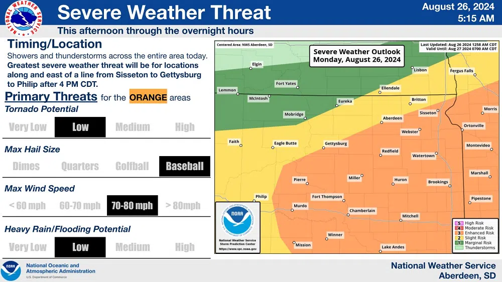
The National Weather Service forecast says showers and thunderstorms are expected across much of South Dakota and the region today (Aug. 26, 2024).
NWS Meteorologist Michael Connelly says one storm system is moving into the western side of the state.
Connelly says those who prefer coolers temperatures than the mid to upper 90s we’ve been having will find a silver lining to these storm systems.
Connelly says there’s also a storm system in northeastern part of the state.
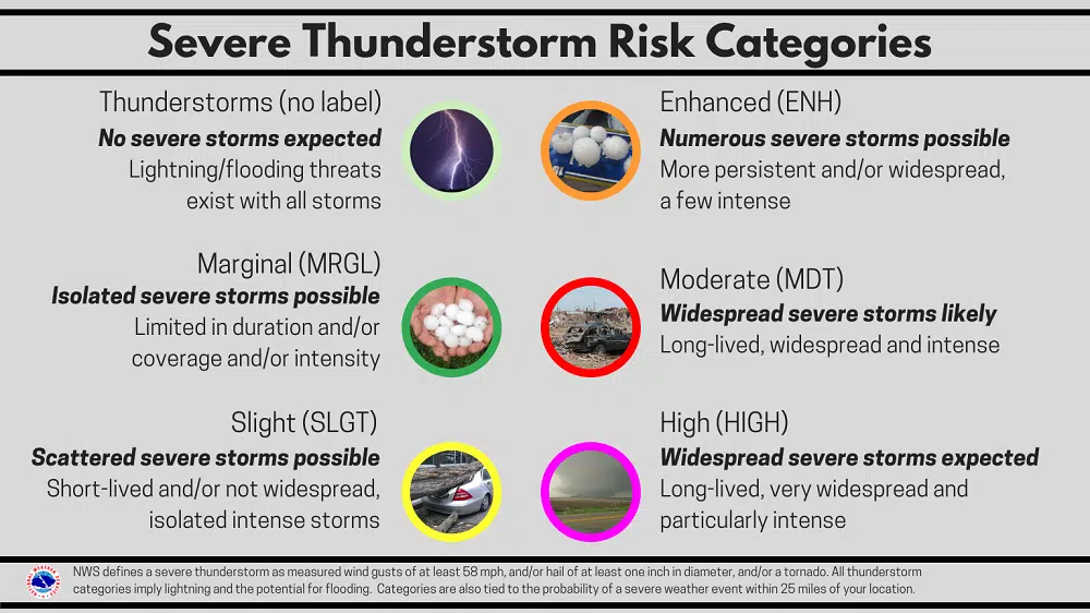
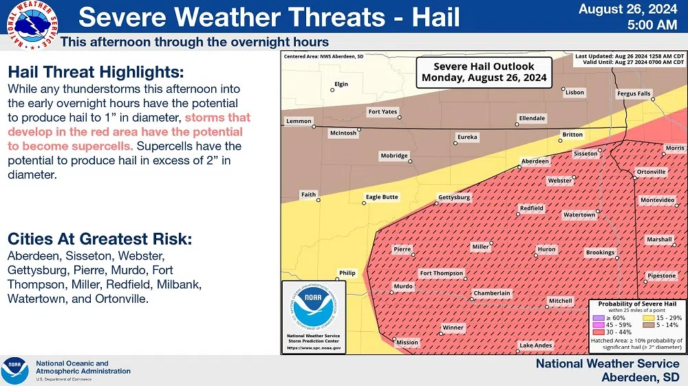
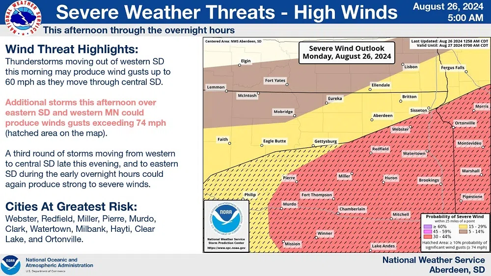
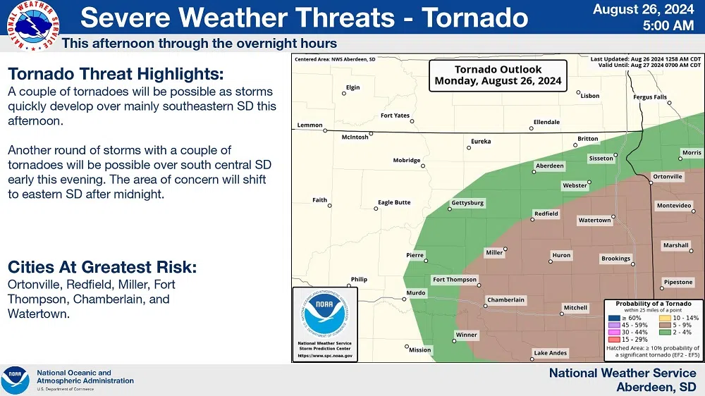
Again, there’s an enhanced risk (level 3 of 5) of severe weather today with the highest probability being southeast of a line from around Pierre to Aberdeen. She says all types of severe weather are possible– including heavy rain, large hail, flooding, damaging winds and the potential for tornadoes.
AUGUST 26, 2024:
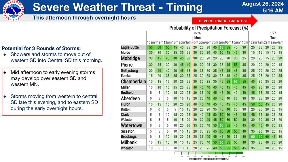
The National Weather Service forecast says showers and thunderstorms are expected today (Aug. 26, 2024), into the early overnight hours.
NWS Meteorologist Kari Fleegel says there are three systems in play– one of which started in the Rapid City area this morning.
Fleegel says another system is expected to start this afternoon.
As far as narrowing down the area that could get hit the worst, Fleegel said as of early this morning it’s difficult to determine.
Again, Fleegel says there’s an enhanced risk (level 3 of 5) of severe weather today with the highest probability being southeast of a line from around Pierre to Aberdeen. She says all types of severe weather are possible– including heavy rain, large hail, flooding, damaging winds and the potential for tornadoes.
Again, Fleegel encourages people to prepare for the severe weather by thinking about where you will go if severe storms develop.


Comments