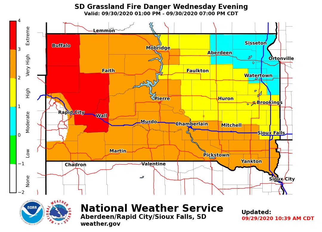
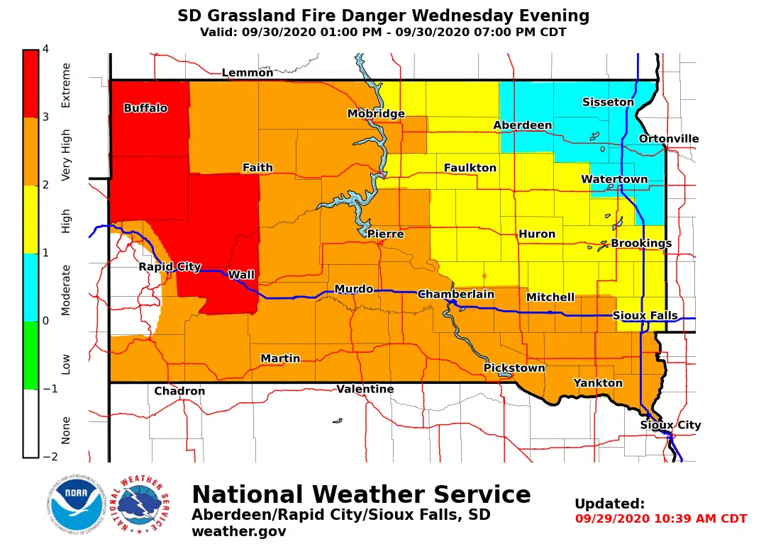
The National Weather Service Grassland Fire Danger map shows most of the counties in western South Dakota have a very high or extreme chance of grassland fire this (Sept. 29) afternoon into early evening (1-7pm).
The Grassland Fire Danger is high today for central South Dakota counties on the east side of the Missouri River from the North Dakota to Nebraska borders.
A few counties in the southeast part of the state also show a very high chance of grassland fire while counties in the northeast part of the state have a moderate chance.

Tomorrow’s map currently shows these conditions:
 The Grassland Fire Danger Index is a forecast of the potential for non-agricultural grasslands to carry fire. The index contains five categories:
- Low
- Moderate
- High
- Very High
- Extreme
Should a fire ignite, it’s more likely to grow or spread during higher rating days.


Comments